Minimum custom amount to enter is AED 2
By donating, you agree to the Privacy Policy and Terms of Service

Located alongside the sea, the people share a maritime culture with nearby countries such as Lebanon and Cyprus.
In 1948, the area known as Palestine was usurped by the declaration of the state of Israel, thus taking control of three-quarters of all the land in Palestine.
Prior to this, the state of Israel did not exist. (Image above is the map of Palestine from the 1947 issue of National Geographic magazine)
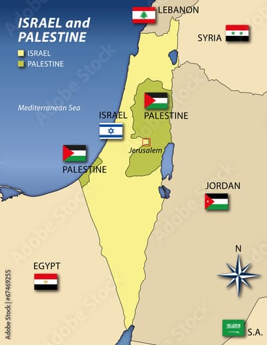
Today, the West Bank and Gaza Strip constitute modern-day Palestine with its capital in East Jerusalem. Bethlehem and Jericho are also located in Palestine.
However, these areas were invaded by the Israeli military and they continue to deny freedom to Palestinians until today.

Who owned the land first Israel or Palestine?
The question of who first owned the land that is now known as Israel and Palestine may seem complex, but the simple fact is there was no Israel on any maps prior to 1948, only Palestine.
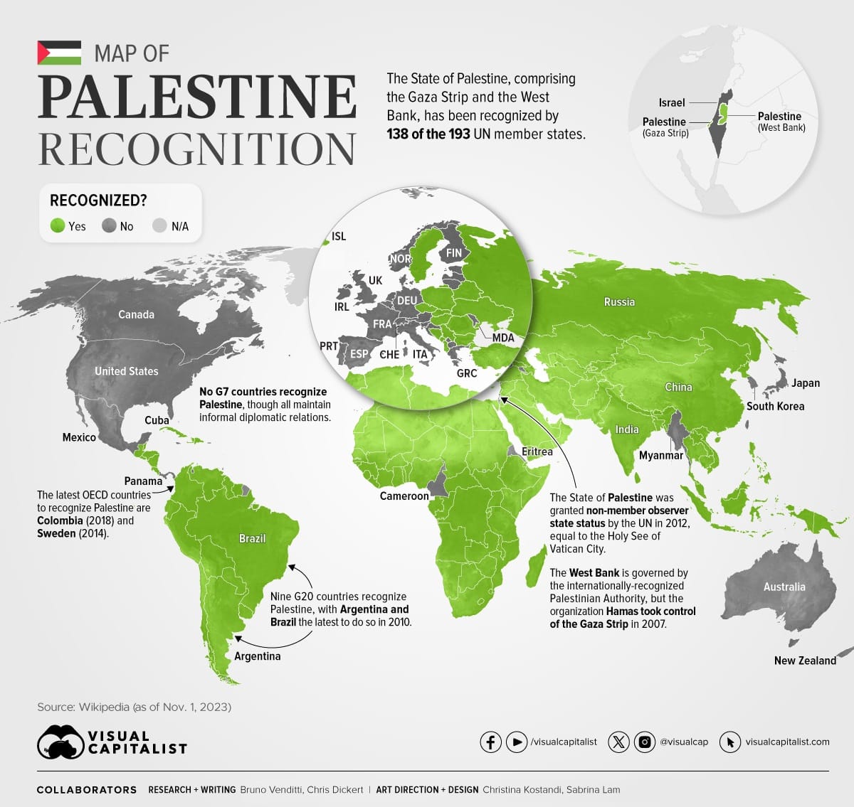
The core of the problem is that although the Palestinian government has come to recognize Israel, the Israeli government still refuses to recognize Palestine. (See image above)
Moreover, the Israeli military occupies all Palestinian territories by force, where it is a major violator of human rights.

The majority of the world recognizes Palestine*, with more and more countries supporting independence and an end to Israel’s invasion of modern-day Palestine.
* Norway, Ireland and Spain recently recognized Palestine in a joint statement.
Minimum custom amount to enter is AED 2
By donating, you agree to the Privacy Policy and Terms of Service